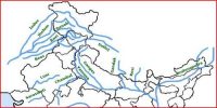
River Systems of the Peninsular Drainage
The Peninsular drainage system is older than the Himalayan one. This is evident from the broad, largely-graded shallow valleys, and the maturity of the rivers. The Western Ghats running close to the western coast act as the water divide between the major Peninsular Rivers, discharging their water in the Bay of Bengal and as small rivulets joining the Arabian Sea. There are a large number of river systems in the peninsular drainage. A brief account of the major peninsular river systems is given below:
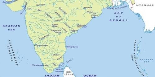
(a) The Mahanadi rises near Sihawa in Raipur district of Chhattisgarh and runs through Orissa to discharge its water into the Bay of Bengal. It is 851 km long and its catchment area spreads over 1.42 lakh sq. km. Some navigation is carried on in the lower course of this river. Fifty-three percent of the drainage basin of this river lies in Madhya Pradesh and Chhattisgarh, while 47 percent lies in Orissa.
(b) The Godavari is the largest Peninsular river system. It is also called the Dakshin Ganga. It rises in the Nasik district of Maharashtra and discharges its water into the Bay of Bengal. Its tributaries run through the states of Maharashtra, Madhya Pradesh, Chhattisgarh, Orissa and Andhra Pradesh.
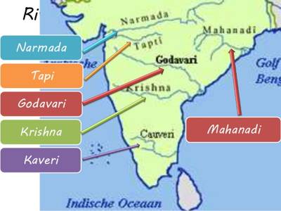
(c) The Krishna is the second largest east-flowing Peninsular River which rises near Mahabaleshwar in Sahyadri. Its total length is 1,401 km. The Koyna, the Tungabhadra and the Bhima are its major tributaries. Of the total catchment area of the Krishna, 27 percent lies in Maharashtra, 44 percent in Karnataka and 29 percent in Andhra Pradesh.
(d) The Kaveri rises in Brahmagiri hills (1,341m) of Kogadu district in Karnataka. Its length is 800 km and it drains an area of 81.155 sq. km. Since the upper catchment area receives rainfall during the southwest monsoon season (summer) and the lower part during the northeast monsoon season (winter), the river carries water throughout the year with comparatively less fluctuation than the other Peninsular Rivers.
(e) The Narmada originates on the western flank of the Amarkantak plateau at a height of about 1,057 m. Flowing in a rift valley between the Satpura in the south and the Vindhyan range in the north, it forms a picturesque gorge of marble rocks and Dhuandhar waterfall near Jabalpur. After flowing a distance of about 1,312 km, it meets the Arabian Sea south of Bharuch, forming a broad 27 km long estuary.
(f) The Tapi is the other important westward flowing river. It originates from Multai in the Betul district of Madhya Pradesh. It is 724 km long and drains an area of 65,145 sq. km. Nearly 79 percent of its basin lays in Maharashtra, 15 percent in Madhya Pradesh and the remaining 6 percent in Gujarat.